Glacier + Yellowstone : Day 3
This post is part 3 of the "glacier_yellowstone_2009" series:
- Glacier + Yellowstone : Day 1
- Glacier + Yellowstone : Day 2
- Glacier + Yellowstone : Day 3
- Glacier + Yellowstone : Day 4
- Glacier + Yellowstone : Day 5
- Glacier + Yellowstone : Day 6
- Glacier + Yellowstone : Day 7
::: {style="text-align: center;"}
 :::
:::
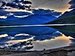
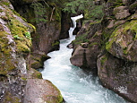
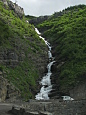
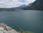
We awoke at sunrise after a surprisingly warmer than expected night. We were prepared for upper 30s, but instead it was about 46F as we broke camp, although it did dip down to 37F along the drive south back to the Going to the Sun Road park entrance. Prior to leaving the campground, I took a few more pictures across the lake, with the sun just beginning to rise (1st from left below (HDR)). The first third of the road (heading east) travels across the valley floor, closely paralleling the McDonald Creek. We stopped to hike the (short) Trail of the Cedars, which is a loop that runs around both sides of the Avalanche Creek. The trail was lush & verdant, with a really pretty waterfall at the half way point (2nd and 4th from left, below):
::: {style="text-align: center;"}
 :::
:::
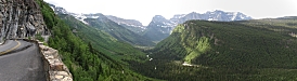
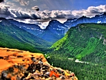
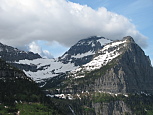
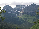
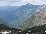
The ascent up towards Logan Pass was quite breathtaking. Due to all the snowmelt, there were waterfalls and cascades everywhere. Sheer glacier carved 9k+ foot tall mountains above (most still with a lot of snow on them), and green, wet valleys below:
::: {style="text-align: center;"}
 :::
:::
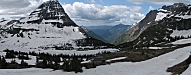
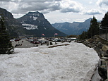
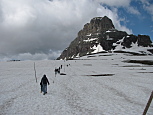
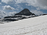
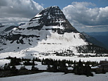
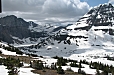
When we reached Logan Pass in late morning, the road had still not opened just to the east, but we didn't care, as it was still scheduled to open eventually that day. We planned to hike to Hidden Lake, which started immediately behind the visitor center(1st from left, 1st row below). It would have been an understatement to say that the trail (1.5 miles each way) was still firmly in the grip of winter. Other than the first 50ft, nearly the entire trail was still under deep snow. In some places, 20ft of snow. This meant that the trail was really not even visible, although that didn't stop quite a feel people from soldiering on up the hillside in the general direction of the lake(2nd from left, 1st row below). Most got as far as the summit of the first hill (which was actually a mountainside which took the trail up and over the continental divide) before deciding that hiking through deep, wet snow, with strong headwinds just wasn't worth it. David & I continued onward, often slipping a foot or more backward for every 2ft that we progressed forward. One particularly challenging area was across a very steep, snow covered hillside(3rd from left, 1st row below), where we were both at risk of sliding down, and backwards all at once. At another point, we came to what appeared to be many small pine trees. However, once we got beside them, I realized that these were fully grown, 20 or 30ft tall pine trees that were buried under a 15ft snow drift upon which we were standing. When we finally reached the overlook,we saw that the lake for which the trail was named, was still almost entirely frozen, and under snow, so that it was barely visible. Regardless, the views were amazing(4th & 5th from left, 1st row below, and both 2nd row below). Immediately behind the lake was Bearhat Mountain (8675ft). To the right was Clements Mountain (8760ft), and to the left was Reynolds Mountain (9125ft).
::: {style="text-align: center;"}
 :::
:::
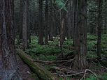
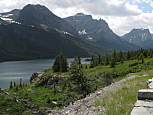
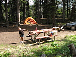
By the time we had finished the hike, the road had officially opened for the year, and we were ready to continue driving eastward. The majority of the rest of the drive through the park was along the north shore of Saint Mary Lake, which was rather pretty. After that, we cut south to our campsite for the next 2 nights, Cut Bank. When we arrived, the entire campground was empty, however it did end up being half full by nightfall. Cut Bank campground has the North Fork of the Cut Bank creek running immediately to the south, and soaring snow covered mountains to the west. The campsites sit at the edge of a forest, with numerous warnings that we were in bear country.
::: {style="text-align: center;"}
 :::
:::
Additional pictures are posted here and here.
This post is part 3 of the "glacier_yellowstone_2009" series: